21st December - 10th March
It was -30 degree celsius when I first arrived in ulaanbaatar. The excitement and nervousness of being in a new place, culture, work and most importantly new people had delayed my brain to register the coldness. It was only the day after when I walked to work that I felt the coldness and my eyelashes were freezing as I walked. And just like that with frozen eyelashes every morning I started working with Ger Community Mapping Center (GCMC).
GCMC is a small ngo that works to “ promotes community mapping as a planning, awareness and outreach tool to advocate for sustainable, participatory and eco-friendly solutions to address local urban problems.” Although a small organization with just three people, (Batdorj, Anu and Oogi, some of the loveliest people during my whole Watson trip) their work was paramount in aiding various government offices make data-driven decisions and hold officials accountable. My Watson journey was marked by working with such small but dauntless organizations bringing immense positive change in the society.
By the time I reached Mongolia, GCMC had already carried out a full fledged project on insulating houses. GCMC in collaboration with another organization were not only raising awareness for house insulation but also insulating the houses at a subsidized cost. In order to further strengthen the case for house insulation, we decided to 3D-heat map the houses, both insulated and uninsulated to study the heat loss.
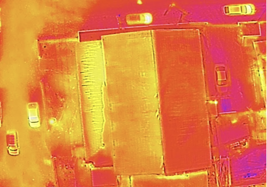
Thermal image of the kindergarten
In order to generate the 3D-heat model of the houses, we flew a DJI Phantom (for the RGB images), Matrice 200 with Zenmuse XT2 (mostly for thermal images), DSLR, and a thermal camera. The idea was to create a RGB based 3D-model and either attach stitched thermal images on each side or entirely create a heat 3D-model if possible. For the trial project, we mapped a kindergarten school. Mapping a single building at a single location made the work easier and faster. However, once we examined the thermal images, we realized the temperature readings were inaccurate. Temperature readings especially through thermal cameras are more inaccurate during the day than night. However, we couldn’t fly drones at night given the numerous cable lines and the harsh cold winter of Ulaanbaatar.
Although I was a little bummed about the heat mapping project not working out, we immediately started another drone mapping project. This time we would use drone mapping to study air, water and soil pollution all at one go. Almost half of the population of the country are in Ulaanbaatar. More than half (51.3%) of those households in Ulaanbaatar live in the Ger area. This area is largely unplanned peri-urban settlement formed from intensive rural to urban migration. Due to the government considering “Ger area” as informal temporary settlement up until recently, the area lacks even the basic infrastructure systems such as water supply, sewage and district heating system.
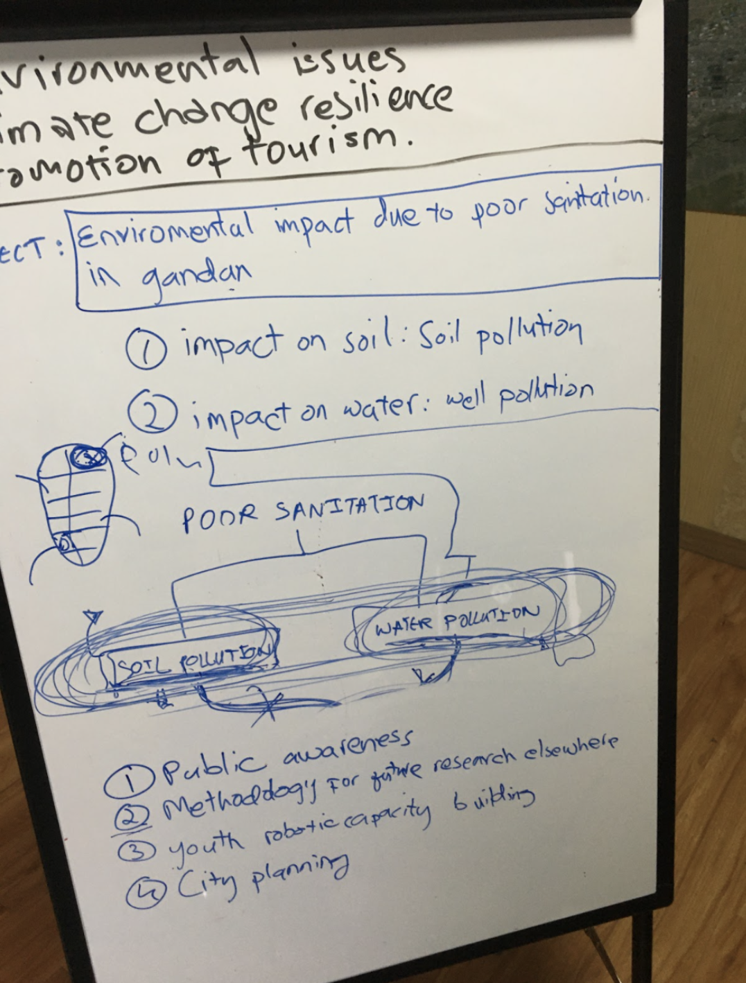

Initial Planning Stage
What allows the study of pollution using drone mapping especially in these areas is because of
uniformity in house
sizes/design and detached toilet. This allows for easier detection, counting and studying of
buildings and toilets. This
would then be connected with the household survey data and the soil, water quality test data.
We started off with Gandan area, the oldest settlement in Ulaanbaatar. The whole mapping of the area took us about two days mostly because the drone batteries weren’t functioning at their maximum capacity due to the cold. Given that there were some tall buildings surrounding the area, at one point we couldn’t locate the drone in the air and we were losing the drone signal. So, what do we do? We just started running in the middle of the street trying to get to a higher elevation to regain signal. Mind you the whole time we were all wrapped in thick jackets and pants while holding a bulky controller and running with our eyes bewildered at the sky (people must have been definitely confused seeing us).
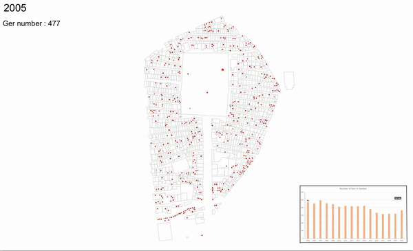
The change in the number of ger (traditional yurt) over the years in Gandan area (produced using drone imagery and google earth pro).
GCMC Team